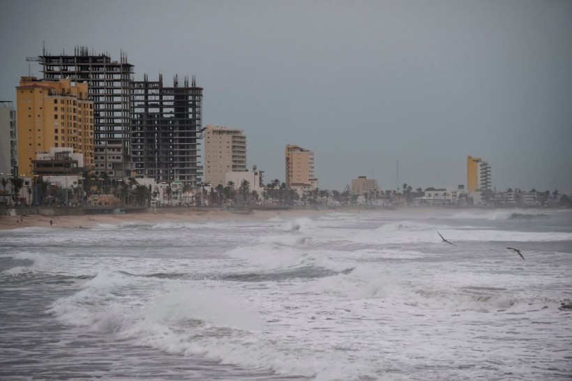
Mexico Faces 2 Straight Tropical Storms as Max Makes Landfall and Lidia Following Close

Two big storms are heading towards Mexico as Tropical Storm Max makes landfall, with Tropical Storm Lidia expected to hit soon after. The southwest Mexican coastline is expected to be the most affected area by these two storms.
According to the Associated Press, Tropical Storm Max made landfall in Mexico's southern Pacific last Monday. It was located around 40 miles (65 kilometers) east of the resort town of Zihuatanejo. It had wind speeds of around 60 mph (95 kph) and was moving inland with a speed of 7 mph (11 kph).
Both the US National Hurricane Center and Mexico's Civil Defense office warned that Tropical Storm Max is causing "torrential" rain in the states of Guerrero and Michoacan. However, flash floods are still very much possible.
While Tropical Storm Max is expected to weaken soon, Mexico would not get a bit of reprieve as Tropical Storm Lidia is expected to follow soon after. The two weather systems are found right next to each other and will hit the country right after the other.
The Mexican government has issued Tropical Storm warnings ahead of Max's path along southern Mexico. High winds, heavy rain, and coastal flooding are all expected along the storm's path.
Tropical Storm Lidia Following Closely Behind Tropical Storm Max; Will Hit Mexico Soon
While Tropical Storm Max is currently battering the Pacific Coast of southern Mexico, Tropical Storm Lidia is expected to arrive soon after and it will be a bit stronger than Max.
According to Fox Weather, the NHC reported that Lidia had maximum sustained winds of around 70 mph. However, it is expected to strengthen as it approaches Mexico.
READ MORE: US-Mexico Relations: Experts Warn on Danger of Aggressive Stance To Curb Fentanyl, Drug Trafficking
Tropical Storm Lidia is currently gaining strength farther north off Mexico's western Pacific coast and was seen around 410 miles southwest of Las Islas Marias, Mexico. It is moving east-northeast with a speed of around 8 mph. With its current speed, the forecast track says its center should approach Las Islas Marias on Tuesday. It is then expected to move inland over west-central Mexico on Tuesday night.
The storm is expected to bring even more swells to Mexico's West Coast and these could cause dangerous surf and life-threatening rip currents. Tropical Storm Watches have been issued, with several warnings of the storm's impact already been made.
Hurricane warnings have been issued to Las Islas Marias, Puerto Vallarta, and Tomatlan, while Tropical Storm Warnings have been given in the areas from Escuinapa to Bahia Tempehuaya and from Manzanillo to Playa Perula.
Tropical Storm Lidia Could Create More Rainfall Around the US
While Tropical Storm Lidia is expected to hit Mexico, the storm may create enough moisture to cause rainfall somewhere else, particularly in the US.
"Some of the moisture and energy from Lidia may transfer to the Gulf of Mexico and perhaps be joined by a second budding tropical system in the Pacific during the middle to the latter part of next week," said AccuWeather Senior Meteorologist Alex Sosnowski. This could mean pockets of rain happening around the Gulf Coast. Affected areas could include Louisiana, Mississippi, and Alabama.
READ MORE: Lionel Messi Height Shows Big Things Come in Small Packages
This article is owned by Latin Post.
Written by: Rick Martin
WATCH: Tropical Weather Forecast - October 8, 2023 - FOX 26 Houston
Subscribe to Latin Post!
Sign up for our free newsletter for the Latest coverage!


