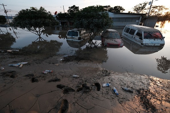
Tropical Storm Eta Makes Landfall in Florida with Life-Threatening Flash Floods

Tropical Storm Eta made landfall in South Florida on late Sunday, bringing "life-threatening' flashfloods.
Hurricane conditions are expected to continue in Florida Keys until Monday, said a report from CNN.
Eta's rainbands will also subject southern parts of the state with high winds, said the National Hurricane Center (NHC).
NHC's Doppler radar data also showed that Eta's maximum wind speed was about 65 miles per hour as it struck the island of Lower Matecumbe Key just south of Islamorada in Florida.
According to Sun Sentinel, the storm's wind field was so wide, reaching up to 310 miles from the storm's center.
Read also: Flooding, Strong Winds Expected as Tropical Storm Eta Makes Landfall in Cuba, South Florida
Other affected areas were Broward, Miami-Dade and Palm Beach counties.
National Weather Service has already reported knee-deep water in Davie and flooding in downtown Fort Lauderdale.
On Sunday night, Eta was moving west-northwest at 14 mph.
"On the forecast track, the center of Eta will pass near or over the Florida Keys tonight and early Monday, and be over the southeastern Gulf of Mexico late Monday and Tuesday," the NHC said.
Until then, rain water can range from a drop up to a foot of rain before Eta retreats to the Gulf of Mexico.
By Monday, South Florida will likely experience high winds, rain and a chance of tornadoes.
Risks of tornadoes will most likely rise at around Sunday night and into early Monday morning as the right side of the storm extends its bands to sweep South Florida.
It is still uncertain when Eta will become a hurricane, said NPR, but forecasters expect heavy rainfall to continue in Cuba, Jamaica, and the Bahamas.
Rains will also be expected as far north as Central Florida.
Second Storm Building Near Florida
After Eta passes through Florida, a second storm is also expected to hit the region shortly after.
The storm is expected to move towards the Gulf of Mexico where it will possibly move to the north and towards the state's western coast.
NHC Director Ken Graham already warned residents that Eta and the possible storm after it will be hitting the state all week.
"It's going to take a while to get this thing out of here," he added.
Florida Braces for Tropical Storm Eta
According to The Weather Channel, Eta will be the first named storm in the season to make landfall in Florida.
The state's Governor Ron DeSantis has already declared a state of emergency on Saturday, ahead of the storm. It covers eight southern counties: Broward, Collier, Hendry, Lee, Martin, Miami-Dade, Monroe and Palm Beach.
At least five school districts cancelled both online and in-person classes Monday, including Miami-Dade and Monroe.
Tropical Storm Eta first devastated portions of Central America before hitting Florida, reported New York Times.
It was a Category 4 hurricane when it hit the region, killing at least 50 people in its wake before it weakened into a tropical depression.
It passed over the Cayman Islands and the northwestern Bahamas on Saturday and made landfall in Cuba on early Sunday.
Now, it is set to hit Florida with storm surges that could reach up to four feet.
The NHC issued a hurricane warning and a storm surge warning for much of the Florida Keys. A flash-flood warning was also issued until 11:45 p.m. on Monday.
Subscribe to Latin Post!
Sign up for our free newsletter for the Latest coverage!
© 2026 Latin Post. All rights reserved. Do not reproduce without permission.


