Flooding, Strong Winds Expected as Tropical Storm Eta Makes Landfall in Cuba, South Florida
Tropical Storm Eta is expected to have its landfall in Cuba and South Florida. The storm devastated Caribbean with heavy rainfall and strong winds as it approaches Cuba.
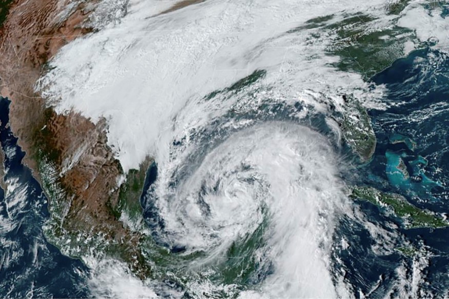
The tropical storm Eta is now moving towards northeast and away from Cayman Islands. The storm is moving to Central Cuba at 13 mph around 1:00 a.m. ET
Eta has sustained winds of 65 mph with tropical storm-force winds extending up to 115 miles out from the storm's center, according to CNN News.
The National Hurricane Center released its latest advisory to warn residents living at the storm's path. The agency said that the center of the tropical storm Eta is forecasted to cross central Cuba in the next few hours and is also expected to approach South Florida and Florida Keys later Sunday.
Tropical storm conditions are forecast by late Sunday in the Florida Keys and some portions of the southeast Florida coast.
The hurricane center warned residents to take precautionary measures.
"Some weakening is possible after landfall in Cuba overnight, but Eta is forecast to re-strengthen later on Sunday and could be near hurricane strength as it approaches and moves near or over Florida."
They also said that people in the affected area should prepare themselves for the heavy rainfall and potential flooding, according to Local 10.
There will be isolated rainfall of more than two feet that is possible to happen in Cuba and the Cayman Islands through the middle of next week.
They also reminded that the heavy rainfall could lead to life-threatening flashfloods and landslides most especially in areas with higher terrains.
A dangerous storm surge of two to four feet is also forecasted along the coast of Cuba near the place where tropical storm Eta is expected to make a landfall on Sunday.
Moreover, hurricane watch and a tropical storm waning is already raised in South Florida and Florida Keys.
Subscribe to Latin Post!
Sign up for our free newsletter for the Latest coverage!
© 2026 Latin Post. All rights reserved. Do not reproduce without permission.


